- PROJECTS
- |
- ABOUT
- |
- INSPIRATION
- |
- TECHNOLOGY
- |
- PROCESS
Technology
Main themes of Letting Go: Sharing Historical Authority in a User-Generated World is that technological innovation as a force of change and impact cultural practice including public history. “Web technologies enable us to use computers in ways that are profoundly human, extending the boundaries of consciousness and memory” How can we embrace change?
Exploring multiple softwares to create the environment I settled on Google Sketch Up. It has many benefits including ease of use, a strong online community with advice, scripts and plug ins to add functionality and a library of objects and components that can be added to your models. The other major justification for Sketch Up is the fact that it is free to everyone. They also have a product that is a product viewer which allows people to interact with the model, walk through, create fly throughs, animation layers and can not change the physical model. Models can be shared with the online community to raise extra awareness about the project.
 Cost involved in the AR Media Technologies plug in which allows you to create self contained augmented reality models that can be triggered using custom designed markers. Also an upgrade to Google Sketch Up Pro is needed to export models to a format that is compatible with the BuildAR authoring environment and the Layar software. A fee is needed to publish your AR site. Features are platform specific. An example was the discovery that some features to keep file sizes down in Sketch Up do not translate to .obj when exporting to AR software.
Initial experimentation into software and to solicit feedback from the public about future content and technology. I participated in Innovation Station at the Vermont Tech Jam. Seven Days wrote an article about the possibilities of augmented reality.
A computer with a webcam is needed to interact with the marker based media, a smartphone is needed to interact with the geo specific models. Note that a smart phone can interact with the marker but has limited access to additional features like cross section, occlude, interactive shading, wire framing, and animation layers. An app is needed for smartphone - Layar Viewer.
Research and Discovery
As my project focuses on travel through history, i started thinking about the nature of time travel and I my theory is that Google Earth and its current quest to document the 3D buildings is in essence inventing a time machine. So going forward into the future 20, 50, or a 100 years, there will be opportunities to travel back to 2012 and be able to see what the world was like. The problem is that is as far back you can go.
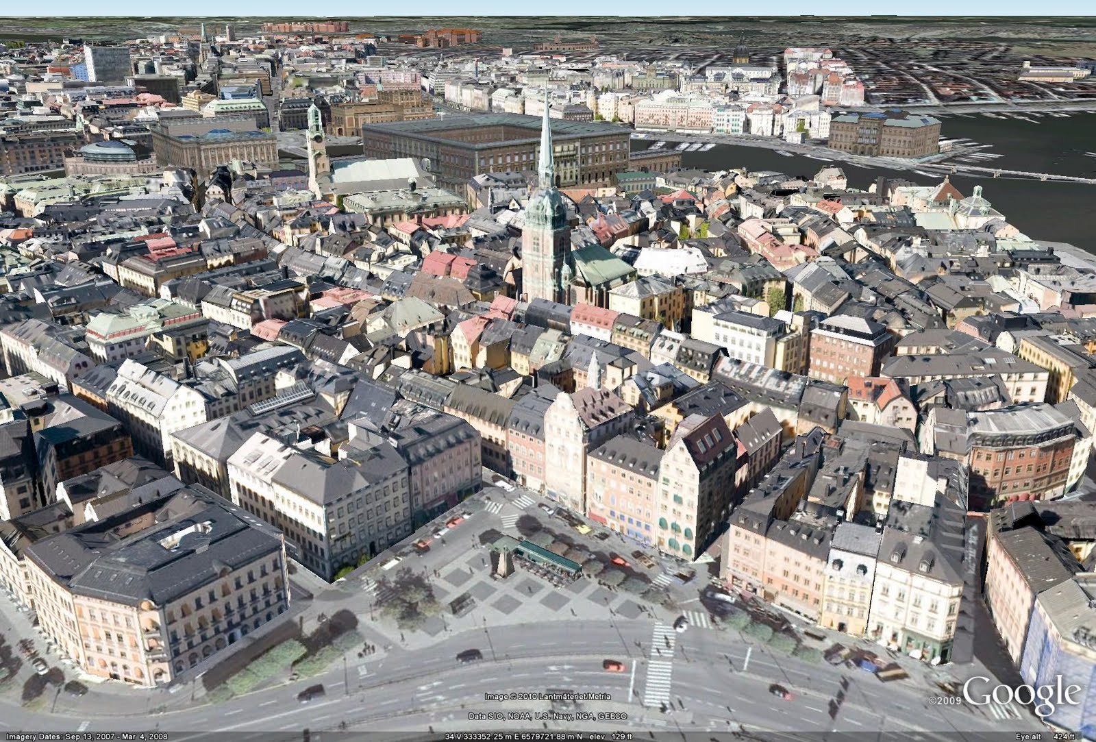 The current method for building this world uses current photographic evidence to map size and construct texture maps. Because of this, it doesn’t have the ability to capture what was in the past or no longer there.
This is a call to action to collect and preserve. So can I work backwards and augment that history as it is being built? Work with what we have now, whether it is a physical artifacts and primary sources in some case much of it has been digitized the result is very large archives and databases that are overwhelming to navigate. There have been some wonderful things done with the idea of tagging elements so you can layer on meaning through categorization. That whole concept of semantics and working toward embedding information with context. Can we go back and supplement that history. You need an artist to create a vision and bring to life that which no longer exist.
For guidance I turned to the practices of museums. In respect to digital assets, the model creation adheres to the guidelines for S.A.V.E. (Serving and Archiving Virtual Environments) an organization that promotes 3D digital models of the world’s cultural heritage sites and monuments. Factors to consider: portability, software and hardware, file size, and file type will insure the assets are compatible with other developers and able to be shared with other artists. Real world dimensions or scale being the most important part of those guidelines. Shared assets can be imported and merged into another environment and have them match up seamlessly.
The first project I researched was the PhillyHistory.org’s Augmented Reality project, sponsored by Philadelphia’s Department of Records. They have a huge archive of photography of the cityscape and they used augmented reality software to pin a select set of photos in three dimensional space based on the geographic location of the original shot. The project use an advisory board and community members to provide content and contextual information about the locations. This project had much of what I wanted to see in my project. The technical challenge and community outreach component. As I looked at the photos I felt something was missing. Seeing the noticeable gaps, It was odd to see only certain things represented. I wondered what it would be like if I was charged to take the photos. What would I have found interesting? What compositions would I frame? How would I record history?
The second project I was the Vermont Landscape Change Program the University of Vermont encouraging people to create pairs of old and new photographs. The process involves going out and finding the location of a historical reference, photographing it and then using the web and map overlay show the relationship of the old and new side by side. I thought was quite successful and included additional information about the photos and location like the architects or historical significance. Both of these projects are attempt to represent large archives and engage audiences in unique and innovative ways.
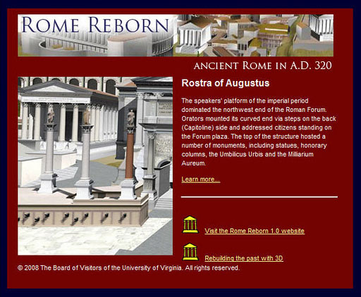 The third project I looked at was the Rome Reborn Project. This a large project that has been around for 16 years. As technology has changed the project has updated it digital model of ancient rome. They also publish their models with Google Earth’s 3D warehouse. They have worked with educators to create lesson plans around the environment and allow students to interact with the environment. This is a component I would want to include in my exploration. The project is huge and is building off of lots of previous research. Is there a way to pick a smaller story with limited resource and scale project goals and process and still create something interesting? This project is currently online and can be accessed for free.
I want to combine the 3D environment of the Rome project, the augmented experience of the Philly project and infuse the information of the landscape change project to create some new and unique.
Augmented Reality
Augmented Reality is a technology that is still in its infancy. There are many applications and possibilities across the spectrum of information, educational, artistic, commercial, and entertainment but current technology fails to go beyond the initial ‘Wow’ factor. The technology is constantly being improved and I sense that in the next five years this technology will become a disruptive force in society as we see physical computing become more prevalent and direct feedback driving our experiences.
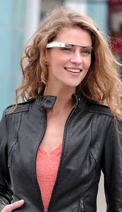 I am fascinated with the idea of seeing something that isn’t visible until you interact with it. From the early pioneering works of Myron Krueger to the recent announcement of the top secret Google Project Glass, human / machine interface is pushing forward. Other projects on the horizon like iOptik from Innovega a contact lens that allows the wearer focus on two fields of view, so they can view a projection and the surrounding scenery at the same show the possibilities.. Both options overlay a computer interface while still allowing you to see your environment. I love the communication from Google on the invention, ‘We started Project Glass to build this kind of technology, one that helps you explore and share your world, putting you back in the moment.’
I admire the thought process of Krueguer, who envisioned the art of interactivity, as opposed to art that happens to be interactive. The idea that explores the space of interaction between humans and computers. The focus on the possibilities of interaction itself, rather than on an art project which happens to have a response to the user.
A quick overview of the two main categories of augmented reality. Geo Spacial, which it based off where you are in space and Image Recognition which is based what you can see. Currently both technologies involve having a computer or smart phone with a web cam enabled.
 Geo spacial involves using the phones GPS, Accelerometer and gyroscope to ascertain where you are in physical space including latitude, longitude and attitude above sea level as well as which way in space you are facing. I was inspired by the application called Star Walk for the iPad which allows you to take your tablet outside and hold it up into the sky at night an it would overlay the constellations, planets, satellites, etc so you could see the connection to your surroundings. The experience is magical.
Although currently the gesture of holding a phone up to get more information may seem awkward or unnatural but will become second nature as more applications like VR codes take advantage of these kind of technologies. Currently the technology allows you to place objects ‘ locators’ in 3D space and can be oriented to alway maintain their orientation such as always facing the viewer, perfect for 2 dimensional objects like a poster or lock into a particular orientation. If you viewed from the side it would seem to disappear as it has width and length but no depth. You can also create 3D object and placing using GPS coordinates. These objects, you can walk around and see the back side if you wanted to.
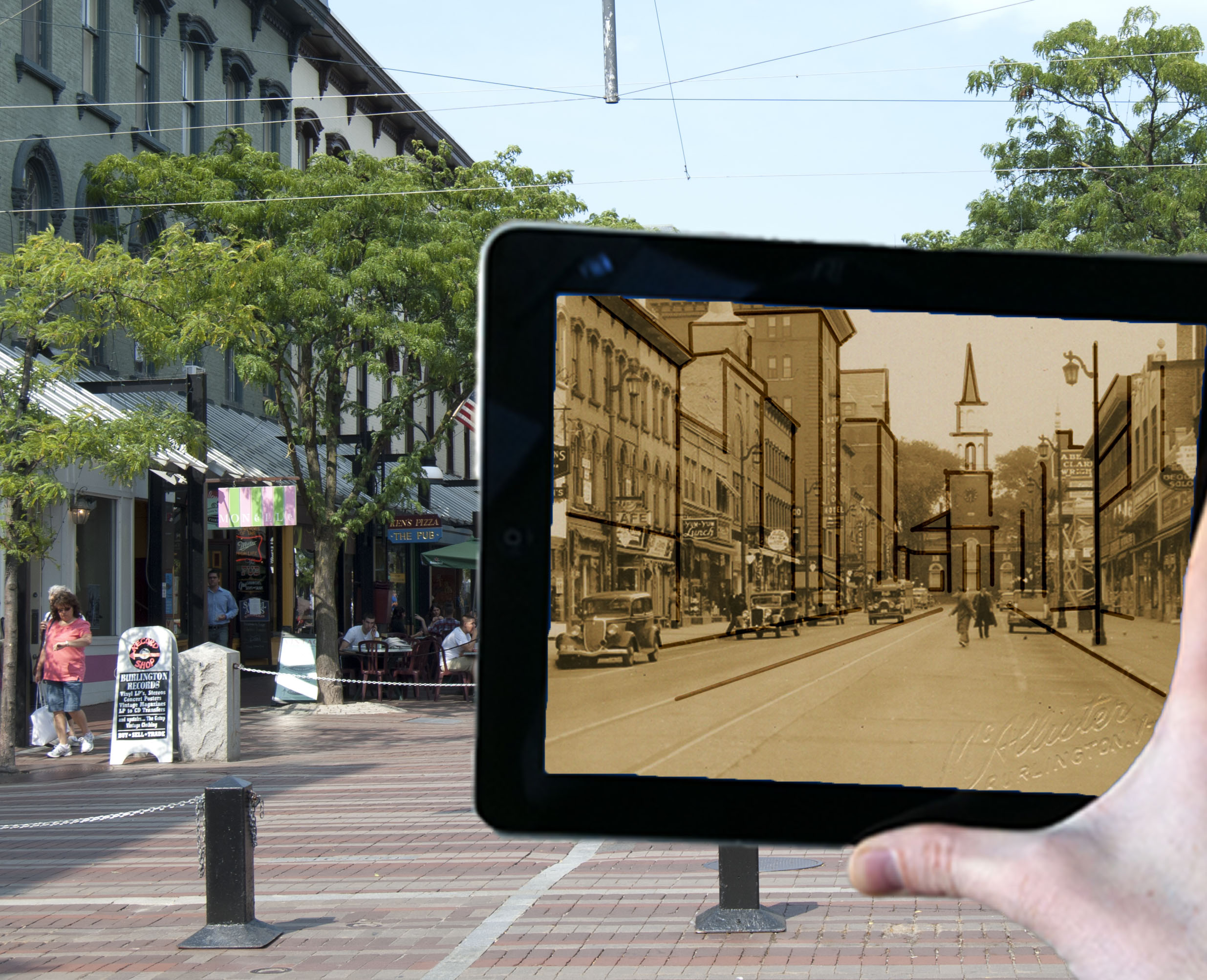
The second augmented reality technology is image recognition. It uses the camera to capture the environment and using image recognition software the software can tell what position the images is in real space and overlay the three dimensional model over it. As the marker moves in space or tilts, the model will update in real time. The marker could be either a specific graphic pattern similar to a QR code or a non moving image such as a magazine ad. Please note that these are similar but separate applications and involve different software to initiate.
Once the augment is launched there are options to interact with the object using your mouse, track pad or touch screen device. Actions such a scaling or rotating object, adjusting lighting, viewing animations, create section views, etc enhance experience. Overlay of menus and extra information about site are accessible and ability to launch websites or other multimedia such as video and audio are available. Other features include capturing the augment with the device camera.
It is important to track how are those tools changing. There are limitations on the technology including speed that currently creates a less than idea interface. Issues such as speed of internet connection, specifications of viewing device, power allocation and assorted glitches or popping of models will benefit from the rapidness of incremental advance in technology. As the project gets bigger make sure there is attention spent dealing with slower updating of models, system get overwhelmed with requests. Occasional program crashes or failure for models to appear properly. Also the set up of the models involve being in the real environment to verify proper placement of elements. Issue of not having proper power supply to run a remote workstation and limited access to internet if wifi not available. Issue of creating models that look amazing in one program, lose some of the aesthetic quality when being exported into other applications.
Concept
 The overall vision is to find a unique way to tell stories. Story telling in an emergent world. The technologies that I found the most fascinate were these alternate realities so can we take these technologies and take a good story and find a way a compelling way to merge the two and engage the audience, whomever they might be in unique and innovative ways. The main dimensions of the project are creativity, innovation and collaboration.
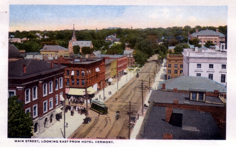
The creation of the model. The goal is to recreate a digital scale model of Burlington Vermont or portions of it and using maps photography, written description, historical records from the Vermont preservation society and gone through and used detective work to find out all the details on the that place. To bring it to life a collection of source material was amassed. The most significant and useful was from a company called Sanborn who have been creating maps which are used fire insurance for over a century. Details include site plan dimension and information about materials; wood framed, brick, or stone, fireplaces, fire walls and connection between building. Location of windows and doors. What was the role of the building domestic - tenant, commercial, store. Obviously later ariel photography is great as far what finding what can of roofs there are. A major resource was from the Center for Digital Initiative at the University of Vermont18, the Wilbur Special Collections, and the photography of Louis L. McAllister who photographed people and places near Burlington Vermont for 60 years. Written descriptions were available from The United States Department of the Interior - National Park Service - Notional Register of Historic Places.
The idea to find a piece a of software wether it is something like Unity were you create a full interactive environment where you have a character can run and jump and look around or closer to what is happening with augmented reality and virtual reality are two interesting possibilities. Current trends with game design of letting the player explore the open worlds as opposed to traditional storytelling were you find the player walking along the plot line with little opportunity to deviate. What better open ended world than the actual world.
There are many opportunities to innovate with the virtual world and augmented reality technologies. I envision three main interactions each showcasing the possibilities of the technology. The first will be the creation of an interactive 3D environment that can be navigated using a computer. The second is the creation of custom markers to interact with the 3D architecture in unique ways. The third is exploring an online AR experience were you need to physically be in the space to interact with the 3D environment as well as with additional contextual information that can be accessed with a smartphone. The goal in education to offer multiple points of entry to a subject. Also different goals or outcomes and different levels of engagement and immersion.
Love the collaborative and participatory nature of the project. Using crowd-sourcing the information and have people supplement parts that are missing or find color photography versus black and white. There is a very real time factor in collecting some of the information and personal reflections as the population ages and the histories get lost.
Challenges
Cost barrier and anticipation to limitations on software and hardware as the project gets bigger. Other scalability issues with finding complete documentation. What happens when I go beyond the knowledge base of the community? How will the assets be administrated. The current direction of memorial has a long expected lifetime. Uncomfortable committing to long term access in current stage. Work on the idea of coordination of launch and assets. Also the volatile nature of hosting and changing protocol addresses. Currently no way of soliciting feedback to make corrections or supplement information.
Opportunities
Looking for images or stories that are distinctive, important or appealing and would benefit from solutions incorporating emergent toolsets. Connect with the local community and discover what they are interested in, find a pertinent problem and see if technology would compliment or elevate the communication around the subject. What other mechanisms did I put into place to further projects visibility and impact. If successful, position work as an example of how technology can assist in creating interesting ways of teaching about history.